You - you need to be a fit and experienced rider to enjoy the routes described here as none are easy primarily due to the hills and also due to some of the distances. You also need to be able to fix your bike as bike shops are few and far between. If you are less experienced why not find a local guide or, try a section of one of the routes before venturing further afield.
Your bike - a road bike or hybrid with a wide range of gears is the very best option on all of these routes. Mountain bikes are fine but only for the shorter routes and I would recommend road going tyres rather than the usual knobly ones. If you're hiring then do make sure that you are comfortable in the saddle for all the obvious reasons. Bike rental is limited and should be booked in advance. E-bikes have started to become available for rent for those who'd like a little help along the way!
Your kit - the absolute bare minimum warm weather kit must include:
- a helmet - sun glasses and sun screen ( I have found P20 to be excellent as you just apply once before you go out) - padded shorts - drinks (two bottles) and snacks - phone(fully charged) and the number of a local taxi firm just in case lunch becomes a longer than expected stop, or you break down... - puncture kit/tubes and pump - cash as you will rarely find an ATM outside of an airport, larger town or large supermarket - route map
As I say this is the bare minimum. Cycle shirts, shoes etc are down to personal choice. I don't travel with much more than that as my camera is in my phone as is my cycling app. It's important to check the weather for your route especially if you start close to the coast and are heading inland. If there's any sign of rain I'll take my lightest weight waterproof jacket.
Outside the main summer season you need to layer up. On a ride in early November it was 18 degs when I set off from the coast and just 8 degs on the tops. That makes for cool descents so carry a lightweight jacket or gilet.
Routes
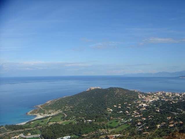
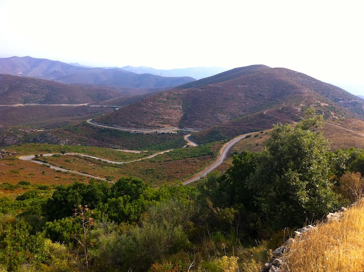
All the routes on this website are on paved roads. Most of these roads are narrow including the Tour de France stages. On the whole the surfaces are fine but in places care will be required because like the Alps, the surfaces take a battering from the weather during the winter. Given the undulating nature of the island there are lots of sharp bends and descents, many of which are steep so apart from ensuring you have great brakes, care is required as you're bound to come across cows, goats, wild pigs, donkeys as well as other traffic and pedestrians all using the same stretch of tarmac! Guard rails are rare. Unlike the UK, there is much better relationship between car drivers and cyclists and pedestrians. A friendly wave or nod, or a bonjour, ça va, merci bien goes a long way to ensuring an entente cordiale on your route.
I've organised my routes into three broad geographic swathes of the island. Most of my routes are designed as a circuit and can be started/finished at any point along the way during a single day. Where a route starts at one point and finishes at another you will need to consider transport.
The North - the area north of Corte all the way to the tip of Cap Corse
The Middle - the area broadly between Corte and Ajaccio
The South - South of Ajaccio and Solenzara to Bonifacio at the very southern tip of the island
The Randonnée - a grand tour of the entire island taking in some 1,500 km and 154 cols
In addition the three 2013 Tour de France routes are mapped out and I have suggested what I think are the best sections to ride.
Note - Corsica does not have the road signs you often see in the Alps and Pyrenees indicating route gradient and distances.
I have tried to make my route data as accurate as possible as there are often significant variations between mapping software. I have tried to iron these differences out by:
Distance - as per RouteYou
Ascent - total metres climbed is an average of RouteYou and MMR (mapmyride)
Max elevation is average of RouteYou and MMR
Max gradient is the steepest part of 0.5km as per RouteYou and MMR. Tipif this causes concern look at the route detail on RouteYou or MMR as often the max is for much less than 0.5km
Average gradient for a route is calculated by summing the metres climbed, where the climb is longer than 0.5km and and the gradient >3%, and dividing this by the distance covered to make those climbs (ie, the average of the hardest bits!)